Monday, June 25, 2012

Arrow Peak from Beartown

Before I moved to Colorado, I had never heard of In N Out Burger.  I believe I met my first California transplant within 10 seconds of arriving here, which means I was already well-informed of the virtues of In N Out by second 12 or so.  It wasn't until a few years later, when I traveled to the Golden State for a triathlon, that I actually got to measure the experience against the hype.  I distinctly remember not being very hungry and only getting one burger, but having just a taste made me want to go back.  I'm pretty sure that the buildup helped make my first In N Out experience a good one.  Similarly, my first trip to the Grenadiers has me wanting to get back there in a big way.

The Plan
I found myself with a great problem:  being in Lake City with no firm plans between the Wayzata trip on Monday-Wednesday and the San Juan Solstice 50 on Saturday.  Instead of putting a ton of miles on the car going back and forth between Lake City and the Springs, I decided to do a little climb instead.  My Lake City 50 plan was to take it easy, avoid going to the well, and make sure I still had some gas in my tank for the upcoming training weeks.  I figured putting in a big day 48 hours before the race would "encourage" me to do just that.  Put another way, I thought two days just under my physical/recovery threshold would be more beneficial than one huge day way beyond my threshold.

Thus, the plan began to take root.  I had mentioned my intentions to Jake a week previously.  After spending a few days off the grid, I returned to Lake City for some coffee and a shower.  It was there that I received a text from Jake telling me that he and his buddy Grant were in for a trip to the Grenadiers and would be rolling into Lake City momentarily.

Our tentative plans was as follows:
Wednesday noon - depart Lake City for the Beartown Trailhead.
Take the Upper Elk Creek approach to the Vestal Basin, or make it as far as possible before dark.
Climb Arrow, Vestal, and the Trinities at a "climbing" (not running) pace on Thursday.
Hike out Friday morning.

The Approach
Simply put, Beartown is out there.  Maybe 20 miles as the crow flies from Lake City, it still took us nearly three hours on some pretty rough jeep road to get to the trailhead.  Lots of very cool scenery along the way, though.

The Rio Grande River, about a mile upstream from the Rio Grande Reservoir.

After quite a few miles of rough 4 x 4 road, we came to the supposed crux of the drive:  fording the Rio Grande.  Sadly, we were correct in assuming that a late-June crossing wouldn't be problematic this year.

Crossing the Rio Grande.  It could definitely be scary in a normal year or with a vehicle lacking high clearance.

The "other" Kite Lake - this is about 2 miles past the Beartown Trailhead and where the Jeep road finally ends.  We felt about as far from civilization as we could possibly be at this spot.

"Selfie" from the trailhead
 We departed the trailhead at 6:00PM on a beautiful Wednesday evening.  The first two miles of hiking found us climbing from 11,500' to a high point of 12,600' on the Continental Divide.  The views in the first two miles were big.

Looking west from the beginning of the trail

We eventually would get to the top of the ridge in the center, veer left(south), then take a right where the Elk Creek trail split off of the CDT/CT.

One of a few abandoned cabins.

Atop the Continental Divide.  The view from here is staggering.
Roach states that from this point, it's a 4.4 mile descent to the Vestal Creek/Elk Creek junction.  This is incorrect - the distance is closer to 5.7 miles.  Luckily, it's hard to miss the beaver ponds that signify the turnoff into Vestal Basin.

Breathtaking.  Elk Creek drops down to the left of this shelf.

Looking down the upper Elk Creek's valley.  Notice the switchbacks in the left foreground; I've rarely seen a trail cut so cleanly through such a pristine place.  Very, very little evidence of people cutting the switchbacks.

I believe this is 13,627' White Dome

Trifecta of wildflower colors.


Looking east, back at the divide after descending the switchbacks into upper Elk Creek.


What makes this approach interesting is that it's a big net elevation loss.  You start at 11,500', climb to 12,600' in 2 miles, then descend for the next 5.7 miles to approximately 10,000'.  Of course, this means you end up re-ascending nearly 3k on your way back out with heavy packs. 

Heart of the Wenimuche

I believe this is 13,475' Peak Two.
As the sun dropped lower, we decided it best to set up camp near the beaver ponds where Vestal Creek joins Elk Creek at 10,000'.  We knew that the initial climb into Vestal Basin was fairly steep.  Anyone who has ever done a multi-day trip knows the dilemma - how far to hike with full packs?  Jake and Grant were both fit, and we figured to be able to get up to the base of Arrow quickly with an early enough start.

The "Snag"
I told Grant I didn't know how to share this important part of the trip without throwing him under the bus.  He replied that he should be thrown under the bus, but I think both Jake and I need to take a little bit of the blame.  The conversation went something like this:

"So...dudes.  I, uhm, didn't bring any food."
"Huh?"
"Well, OK, I brought these four beers.  But, yeah.  I don't have any food."

Grant apologized to both of us for forgetting food.
Jake apologized to me for not checking with Grant beforehand.
I wouldn't apologize to myself for not checking with Grant and Jake.  I know that backcountry protocol involves everyone laying out all of their gear beforehand to eliminate redundancies and avoid problems like this.  That didn't happen.  Further compounding the problem - both Jake and I went as bare-bones as possible on food to keep the weight down.

Thus, the plan had to change.  With all of our remaining food laid out in front of us - including the 960 beer calories - we clearly didn't have the ammo needed to make a sweep of the Vestal group, let alone hit them AND hike the uphill 8 hours back out to Beartown.  Whether we could even get one peak in was up in the air.  We decided that the best course of action would be to call Grant a lot of four-letter words, eat most of his food, cover him in honey, stick him in the bear bag overnight and hope for nature to take care of the rest.  He resisted this plan.  Instead, we chose to play it by ear and maybe at least get up one peak in the morning.  A rationed dinner made, tents set up, and we were sawing logs by 11:30.

Arrow Peak
Alarms woke us a little before 5:00.  Skipping out on most of our planned breakfast, we ingested a bit of caffeine and began the climb into Vestal Basin by 5:45.

Crossing Elk Creek can be problematic; with the low rainfall this year, we found it to be trivial.

Vestal and the Trinities come into view.

Getting to the upper basin proved to be a little more challenging than we thought; we couldn't find the turnoff for Arrow in the thick underbrush and ended up bushwhacking quite a ways east.

Vestal's famous Wham Ridge

Traversing back to Arrow's base

Getting ready for "the ramp"

"The ramp"

Arrow's ramp is mellow at first, but gradually steepens as you approach the summit

The classic Vestal-from-Arrow picture.  I used to think anyone who free soloed Wham was a nutjob; after both seeing it for myself and talking to two guys who have done it, I'm thinking it's doable if you don't mind a lot of air under your butt.
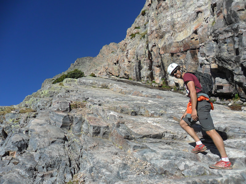
We initially just took the left ramp up, keeping an eye on the traverse options to the right ramp.  A little past 13,000', though, Jake and I talked.  It appeared that the left ramp/ridge might go.  The rock was super solid - much moreso than the class 3 right ramp.  Grant was comfortable enough to give it a shot, and we found ourselves with nearly 1k of class 3+/4 bliss all the way to the summit.


Kudos, mountain goat.  13,750' and you must've been rockin' it when you snagged this on a rock.
 We re-joined the standard route maybe 50 feet from the summit.  I'll say it again - if you prefer solid rock with exposure over looser but less steep stuff, forget the ramp.  Stay far left, almost till you hug the NE ridgeline, and you will find one of the most enjoyable scrambles you've ever had.

Summit - 13,803'
 I wish we could've stayed on the summit all morning, but we had a LONG way to get back to civilization.  4 hours to camp, another 4 to the car, another 3 to Lake City, and another 5 for the other two to get back to COS.  Not only that, the longer we stayed, the higher the chances that our lack of food would come back to haunt us.  We chose to descend the standard route.

Descending.  The lower/left(when up-climbing) ramp is clearly visible here.


Looking down at the lower meadow before descending into it.  There was a tent; we also saw two guys over on Wham during our ascent.

We'll be back.  With food.
 We were back at camp by 1:00 and heading back up heavy by 2:00.

One last look from the beaver ponds
 The trip back up to the Divide was rough.  I bonked in a serious way.  Jake, being the Navy guy he is, dropped his bag off at the divide, ran back down the trail, met me at the bottom of the switchbacks, and took my bag from me.  His justification was that I needed to save my legs for Saturday's fun run.  Truth be told, the damage had already been done.  24 miles in 24 hours doesn't wreck me, but it surely doesn't leave me feeling fresh the next day!  Nonetheless, Jake, I again thank you.

All downhill from here.
 We got back to the jeep a few minutes before 6:00 - it took about 4 hours for us to hike out.  We were out of food, and the next challenge was to make it back to Lake City for dinner before the town's seemingly mandatory 9:00 closing time.


Mmmmmm, burger.


We did make it to Lake City in time, getting in our orders for Pork Taco's at Southern Vittles at 8:45PM.  Food is amazing when you're starving.

Our approach.  Beartown on the left.

Climb into Vestal Basin.
Closer view of the scramble.  Ascent is generally the left line, descent is the right.

Closing Thoughts
  • The Beartown/Upper Elk Creek approach is special.  Remote, spectacular, time-consuming, and rewarding are all apt descriptors.  
  • Arrow is one of my new favorite climbs; only on Capitol's "North Ridge Direct" have I found that much continuous class 3+/4 fun.  
  • I think if I could do it all over again, I would forgo the heavy pack and daytrip it from Beartown.  Making it from TH to Beaver Ponds with a light pack could be done in half the time, and the re-ascent of Elk Creek wouldn't be so bad if one was traveling lightweight.  
  • Vestal looks 100% pure fun; the Trinities do as well.
  • Grant owes me dinner.  Preferably In N Out Burger.

Redcloud, Sunshine, Handies

Catching up here in the blogosphere, as I've been off the grid for the majority of the past week.  Last Tuesday, I had the pleasure of chaperoning the Wayzata cross-country team up a fourteener for the seventh consecutive summer.  This year, they actually got to do a "twofer" - both Redcloud and Sunshine Peaks in the San Juan range.  Later that evening, a couple of us went for a sunset hike of Handies Peak.  7,000' slow and easy.  Good times.

Sup?

The guy with the beard was my high school coach.


Atop Redcloud.  In past years, these boys (well, not exactly this group, but the top 10-14 kids from the team on any given year) have seen the summits of La Plata, Humboldt, Pikes, Uncompaghre, Massive, Lindsey, and Sunshine.


Fun with snow.

Heading up Handies in the late PM hours.

Thirteeners in the background.

San Juans

Summit cheese.  Fun day.


Wednesday, June 13, 2012

Elbert, Massive, etc

I guess summer is in full swing, today being the 13th weekday since school ended and all.  To date, though, I've only had one true "day off".  I just got back from Cheyenne Mountain's annual high altitude training camp.  I definitely made the most of it, getting on top of South Almagre last night at sunset.  This morning, some of the kids and I made it to the higher of the Almagre summits at 12, 367'.  The views of both Pikes to the NW and the city below are awesome.

11-ish miles.  Low point of 10,300' or so, plenty of runnable miles through some spectacular meadows on the south side of Pikes.
I was able to squeeze in a big mountain day on Monday with my new partner in crime, Jake.  He's up for most anything as long as it's tough.  I asked him if he wanted to take a look at some possible variations on the Nolan's run and he of course obliged.  My question was this:  seems many folks choose to descend Massive's SW slopes and ascend Elbert via the quiet W face route.  I figured we could do a loop to see to compare the two western routes to the standard eastern ones.

Started at North Halfmoon Creek (nine o clock-ish in this picture) and went counterclockwise, summitting Elbert via the its west face, descended down the northeast ridge (mostly), joined the CT, up Massive via the standard east face route, back to camp via the SW slopes.


The view of Elbert from the west.  We shot straight up the gulley in the middle and then joined the rightmost ridge.  Steep, but good footing.


Massive in the background

Top of Elbert, looking south.  La Plata is the cool bowl-looking one just left of center.

Mountain running!


Taking a break on our way up Massive.  I love this trail.

Massive's summit, noonish.


Jake standing proud next to his makeshift shelter.

Going down and up the east sides of these two mountains is a few miles longer than taking the western route.  I get why people would want to take as many shortcuts as possible.  We found the descent off of Massive's southwest slopes to be awful.  Rocky, steep, and jarring.  A few of those downhill miles averaged 30 minutes per mile...a pace we could do more quickly on most uphills.  Elbert's west face is a nifty little route, but besides the first mile and a half, isn't runnable at all.  I think that even though it's a bit longer, I'd prefer to take the "standard" routes and save the wear and tear on my legs that the western routes would cause.

There's a lot on my plate over the next couple of weeks.  I'm excited for it all.  The Nolan's run-through is coming up on the July 4th weekend.  I feel confident in almost the entire route.  The whole up-and-down Princeton part is probably the most problematic remaining, but I think we'll be able to figure that one out on the fly.  I'll be running flat miles for the next few days due to a conference I'm attending in Denver, and then my old high school team comes into town for their annual Colorado 14er trip.  When they leave on Wednesday, I'll stay in Lake City, climb a few peaks on Thursday, and get ready for a 50 mile fun run there on Saturday!


Monday, June 4, 2012

Little Browns Creek Mountain Marathon

The Shavano "Marathon"
Mt. Antero, Tabeguache Peak, and Mt. Shavano from Browns Creek TH 
26.3 miles
9,750' gain
10 hours, 20 minutes of fun
Hikers/Climbers/Runners/Whateverers:  Me, Jake, Christoph*

I had a free weekend, so I figured I better spend some time on my feet.  On Saturday, I ran the 26.5 miles from Palmer Lake to my place in 3:33.  No Boston qualifier, but the 8:00 miles did feel good.

Sunday's plan came together as the week progressed; I'd known I wanted to get into the mountains for something long, but had a bunch of ideas.  By mid-week, I had done some research and decided that hitting the Shavano group would be a good run.  I also hoped to scout out more of the Nolan's 14 course.  (I had already been to the top of all three peaks, but had never been in the basin between Antero and the other two)  Christoph was up for a day in the mountains.  So was Jake, a sophomore at the Naval Academy who used to run for Cheyenne Mountain.  Crew assembled; game on.


The route - start at Browns Creek TH west of Buena Vista.  Up Little Browns Creek trail until we got bored, then up Antero's SE face.  Down Antero, into the Browns Creek basin, up to the Carbonate-Tabeguache saddle, complete the Tabeguache-Shavano traverse, standard Shavano trail to Blank Cabin TH, Colorado Trail back to Browns TH.  Got all that?

Wheels up at 6:30.  A little on the late side, but we move.

Browns Creek TH serves both Browns Creek Trail and Little Browns Creek Trail.  From the TH, a trail goes about 1.7 miles until it hits the Colorado Trail.  From here, you go left on the CT for a short while to catch the Browns Creek Trail.  Of course, the creek you cross en route is Little Browns Creek.  If you want to get on the Little Browns Creek Trail, don't turn towards Little Browns Creek; instead, go right on the CT for a little bit before making a left at Little Browns Creek Trail.  The good news is that all of these junctions are clearly marked.

Little Browns Creek Trail was somewhat undulate-y.  For us, it was about 75% runnable going up.  As with everything else I've seen in the Sawatch this spring, there was quite a bit of deadfall.

The trail is lest densely forested than those in the northern Sawatch.  This cool little clearing must've been around 10,000'.

Mt. White in the background.  Our route would find us circumnavigating the whole thing.

Around treeline.  Christoph decided at this point to bag any idea of hitting a bunch of peaks, as he wasn't feeling too hot.

9AM - 3:30 into our day.  Jake looking out toward our next objective - Tabeguache. 

I didn't particularly enjoy any of these three peaks when I did them individually the first time around.  However, I had read enough trip/race/experience/adventure reports from people who had done portions of Nolan's 14 to know that getting sidetracked and lost, even for a couple of miles, can spell the end of one's adventure.  More than one party had gotten confused and/or lost during this part, or had chosen a route that required a great more deal of effort than necessary.  I wanted to get familiar with the Browns Creek basin in case I had to deal with this portion in the dark.  Instead of ascending up the Tabeguache/Shavano saddle (which by every account I've ever read is horrible), I thought it might be more expedient for us to gain the Tabeguache/Carbonate saddle.

We took Jeep roads down from Antero for as far as we could.  Eventually we had to bite the bullet and bushwhack across the upper basin.

Looking up to the Tabeguache/Carbonate saddle.  Notice the clouds...trust me, we did.  We knew we were racing time and were in full-on kick ass mode, as the next couple miles were all very high and exposed.

The view east to Tabeguache's summit from point 13,936.  It's interesting to note a comment Roach makes in his book about the current standard route up Tabeguache, which involves first summitting Shavano.  He mentions his concern over being above treeline for a long time, thereby inviting bad weather.  One look here makes me say it doesn't really matter - in order to get to the top of Tabeguache, you are going to have to spend a good deal of time near 14,000' no matter how you do it.  We had just gained almost 2,000' in VERY short order.  The clouds hadn't yet fully formed.  There were isolated patches to our north and west, but we knew we were on borrowed time.

Jake near the summit, looking east toward Shavano and wondering which one of us was going to get struck my lightning.

"LET IT BE ME, LORD.....LET IT BE ME!!!"  Tempting fate.

Once we got to Tabeguache, our bailout option finally switched from backtrack to drop down the Tabeguache/Shavano saddle to the north into Browns Creek.  As we busted ass down Tabeguache, we noticed a couple dudes hiking down Shavano, obviously looking to summit Tabeguache.  OK...by now, I was convinced Jake and I were idiots.  But these guys...were willingly pushing on.  A small wall of rain/graupel/something was about to hit us, but behind it was another stretch of clear skies.  They seemed unconcerned, as this would surely pass.  I've learned enough to not preach on the mountain.  And who was I to talk anyway. We were up high too, but I did share our plan to skirt around the summit as we didn't like what we were dealing with.  Sure enough, within two minutes of parting ways, I felt it..."JAKE, GET DOWN!"  No questions asked, we hunkered down at 13,800'.  Less than a minute later, flash and boom from not too far away.  These other two guys let that serve as their warning to turn around and joined us.

Right after a strike...

...and right before another one.  Yes, your hair really does stand on end.  Another eerie thing - if there's a lot of charge in the air, you can stick your hand up and hear it.  Don't stick your hand up.  :/  How about don't get stuck up high during an electrical event?

The last bit passing by.  Mammatus clouds, I believe?

Back in the sun on Shavano's summit.

Down, down, down.

The "impassable deadfall" on Shavano's standard route.  Hey Forest Service dudes...you guys are freaking awesome.  Seriously, some amazing work to clear the trail!

Some sort of demonic deadfall hatchling I suppose.

"Hey Jake, do you want Christoph to pick us up at Blank Cabin?"  "Nah, I want to run the Colorado Trail!"  And thus, an 18-mile day became a 26-mile day.  We each had our last sip of water at Blank Cabin.  The last 8 miles (the sign at Blank Cabin says it's only 5...yeah, right) were TOUGH, but beautiful.

When it was all said and done, we covered 26.3 miles.  I had no intentions of running back-to-back marathon distances days, but there it was.  I ended up with 101 for the week...somewhat by accident.  A great day, though, as I got to see much more of this area than I ever experienced during my initial climbs of these three peaks nearly ten years ago.  We stopped at the Coyote Cantina in Johnson Village, ate like kings, and began scheming for the next meaty mountain loop.

Disclaimer:  OK, so let me get this straight.  Getting stuck up high during a storm is no picnic.  Could it have been avoided?  Yep.  An earlier start would've been the best defense.  In 100+ summits of 14,000' peaks, this was the sketchiest weather I've ever had to deal with.  Considering the stories I've heard from others, I consider myself lucky.

Ultra-types:  Another pretty cool loop.  Of the 26 miles, I'd estimate we were able to run about 13-15 of them.  Going Antero first allowed us to run the jeep roads down for a few miles...it might be pretty difficult to run them upward.  The icing on the cake was the stretch of the CT from Blank Cabin to Browns Creek...beautiful stuff.

Hikers:  Little Browns Creek is a way to take in some otherwise ho-hum mountains.  I distinctly remember being kind of jaded by Antero - the roads, gem-diggers, 4x4's, etc.  Approaching this way meant we didn't have to deal with the junk show until the very end.  For those of you who kind of like the "solitude" thing, forget Baldwin Gulch!

26, 45, close enough.  Cannot wait till this album comes out in July.