Catching up here in the blogosphere, as I've been off the grid for the majority of the past week. Last Tuesday, I had the pleasure of chaperoning the Wayzata cross-country team up a fourteener for the seventh consecutive summer. This year, they actually got to do a "twofer" - both Redcloud and Sunshine Peaks in the San Juan range. Later that evening, a couple of us went for a sunset hike of Handies Peak. 7,000' slow and easy. Good times.
Sup?
The guy with the beard was my high school coach.
Atop Redcloud. In past years, these boys (well, not exactly this group, but the top 10-14 kids from the team on any given year) have seen the summits of La Plata, Humboldt, Pikes, Uncompaghre, Massive, Lindsey, and Sunshine.
I guess summer is in full swing, today being the 13th weekday since school ended and all. To date, though, I've only had one true "day off". I just got back from Cheyenne Mountain's annual high altitude training camp. I definitely made the most of it, getting on top of South Almagre last night at sunset. This morning, some of the kids and I made it to the higher of the Almagre summits at 12, 367'. The views of both Pikes to the NW and the city below are awesome.
11-ish miles. Low point of 10,300' or so, plenty of runnable miles through some spectacular meadows on the south side of Pikes.
I was able to squeeze in a big mountain day on Monday with my new partner in crime, Jake. He's up for most anything as long as it's tough. I asked him if he wanted to take a look at some possible variations on the Nolan's run and he of course obliged. My question was this: seems many folks choose to descend Massive's SW slopes and ascend Elbert via the quiet W face route. I figured we could do a loop to see to compare the two western routes to the standard eastern ones.
Started at North Halfmoon Creek (nine o clock-ish in this picture) and went counterclockwise, summitting Elbert via the its west face, descended down the northeast ridge (mostly), joined the CT, up Massive via the standard east face route, back to camp via the SW slopes.
The view of Elbert from the west. We shot straight up the gulley in the middle and then joined the rightmost ridge. Steep, but good footing.
Massive in the background
Top of Elbert, looking south. La Plata is the cool bowl-looking one just left of center.
Mountain running!
Taking a break on our way up Massive. I love this trail.
Massive's summit, noonish.
Jake standing proud next to his makeshift shelter.
Going down and up the east sides of these two mountains is a few miles longer than taking the western route. I get why people would want to take as many shortcuts as possible. We found the descent off of Massive's southwest slopes to be awful. Rocky, steep, and jarring. A few of those downhill miles averaged 30 minutes per mile...a pace we could do more quickly on most uphills. Elbert's west face is a nifty little route, but besides the first mile and a half, isn't runnable at all. I think that even though it's a bit longer, I'd prefer to take the "standard" routes and save the wear and tear on my legs that the western routes would cause.
There's a lot on my plate over the next couple of weeks. I'm excited for it all. The Nolan's run-through is coming up on the July 4th weekend. I feel confident in almost the entire route. The whole up-and-down Princeton part is probably the most problematic remaining, but I think we'll be able to figure that one out on the fly. I'll be running flat miles for the next few days due to a conference I'm attending in Denver, and then my old high school team comes into town for their annual Colorado 14er trip. When they leave on Wednesday, I'll stay in Lake City, climb a few peaks on Thursday, and get ready for a 50 mile fun run there on Saturday!
The Shavano "Marathon" Mt. Antero, Tabeguache Peak, and Mt. Shavano from Browns Creek TH 26.3 miles 9,750' gain 10 hours, 20 minutes of fun Hikers/Climbers/Runners/Whateverers: Me, Jake, Christoph*
I had a free weekend, so I figured I better spend some time on my feet. On Saturday, I ran the 26.5 miles from Palmer Lake to my place in 3:33. No Boston qualifier, but the 8:00 miles did feel good.
Sunday's plan came together as the week progressed; I'd known I wanted to get into the mountains for something long, but had a bunch of ideas. By mid-week, I had done some research and decided that hitting the Shavano group would be a good run. I also hoped to scout out more of the Nolan's 14 course. (I had already been to the top of all three peaks, but had never been in the basin between Antero and the other two) Christoph was up for a day in the mountains. So was Jake, a sophomore at the Naval Academy who used to run for Cheyenne Mountain. Crew assembled; game on.
The route - start at Browns Creek TH west of Buena Vista. Up Little Browns Creek trail until we got bored, then up Antero's SE face. Down Antero, into the Browns Creek basin, up to the Carbonate-Tabeguache saddle, complete the Tabeguache-Shavano traverse, standard Shavano trail to Blank Cabin TH, Colorado Trail back to Browns TH. Got all that?
Wheels up at 6:30. A little on the late side, but we move.
Browns Creek TH serves both Browns Creek Trail and Little Browns Creek Trail. From the TH, a trail goes about 1.7 miles until it hits the Colorado Trail. From here, you go left on the CT for a short while to catch the Browns Creek Trail. Of course, the creek you cross en route is Little Browns Creek. If you want to get on the Little Browns Creek Trail, don't turn towards Little Browns Creek; instead, go right on the CT for a little bit before making a left at Little Browns Creek Trail. The good news is that all of these junctions are clearly marked.
Little Browns Creek Trail was somewhat undulate-y. For us, it was about 75% runnable going up. As with everything else I've seen in the Sawatch this spring, there was quite a bit of deadfall.
The trail is lest densely forested than those in the northern Sawatch. This cool little clearing must've been around 10,000'.
Mt. White in the background. Our route would find us circumnavigating the whole thing.
Around treeline. Christoph decided at this point to bag any idea of hitting a bunch of peaks, as he wasn't feeling too hot.
9AM - 3:30 into our day. Jake looking out toward our next objective - Tabeguache.
I didn't particularly enjoy any of these three peaks when I did them individually the first time around. However, I had read enough trip/race/experience/adventure reports from people who had done portions of Nolan's 14 to know that getting sidetracked and lost, even for a couple of miles, can spell the end of one's adventure. More than one party had gotten confused and/or lost during this part, or had chosen a route that required a great more deal of effort than necessary. I wanted to get familiar with the Browns Creek basin in case I had to deal with this portion in the dark. Instead of ascending up the Tabeguache/Shavano saddle (which by every account I've ever read is horrible), I thought it might be more expedient for us to gain the Tabeguache/Carbonate saddle.
We took Jeep roads down from Antero for as far as we could. Eventually we had to bite the bullet and bushwhack across the upper basin.
Looking up to the Tabeguache/Carbonate saddle. Notice the clouds...trust me, we did. We knew we were racing time and were in full-on kick ass mode, as the next couple miles were all very high and exposed.
The view east to Tabeguache's summit from point 13,936. It's interesting to note a comment Roach makes in his book about the current standard route up Tabeguache, which involves first summitting Shavano. He mentions his concern over being above treeline for a long time, thereby inviting bad weather. One look here makes me say it doesn't really matter - in order to get to the top of Tabeguache, you are going to have to spend a good deal of time near 14,000' no matter how you do it. We had just gained almost 2,000' in VERY short order. The clouds hadn't yet fully formed. There were isolated patches to our north and west, but we knew we were on borrowed time.
Jake near the summit, looking east toward Shavano and wondering which one of us was going to get struck my lightning.
"LET IT BE ME, LORD.....LET IT BE ME!!!" Tempting fate.
Once we got to Tabeguache, our bailout option finally switched from backtrack to drop down the Tabeguache/Shavano saddle to the north into Browns Creek. As we busted ass down Tabeguache, we noticed a couple dudes hiking down Shavano, obviously looking to summit Tabeguache. OK...by now, I was convinced Jake and I were idiots. But these guys...were willingly pushing on. A small wall of rain/graupel/something was about to hit us, but behind it was another stretch of clear skies. They seemed unconcerned, as this would surely pass. I've learned enough to not preach on the mountain. And who was I to talk anyway. We were up high too, but I did share our plan to skirt around the summit as we didn't like what we were dealing with. Sure enough, within two minutes of parting ways, I felt it..."JAKE, GET DOWN!" No questions asked, we hunkered down at 13,800'. Less than a minute later, flash and boom from not too far away. These other two guys let that serve as their warning to turn around and joined us.
Right after a strike...
...and right before another one. Yes, your hair really does stand on end. Another eerie thing - if there's a lot of charge in the air, you can stick your hand up and hear it. Don't stick your hand up. :/ How about don't get stuck up high during an electrical event?
The last bit passing by. Mammatus clouds, I believe?
Back in the sun on Shavano's summit.
Down, down, down.
The "impassable deadfall" on Shavano's standard route. Hey Forest Service dudes...you guys are freaking awesome. Seriously, some amazing work to clear the trail!
Some sort of demonic deadfall hatchling I suppose.
"Hey Jake, do you want Christoph to pick us up at Blank Cabin?" "Nah, I want to run the Colorado Trail!" And thus, an 18-mile day became a 26-mile day. We each had our last sip of water at Blank Cabin. The last 8 miles (the sign at Blank Cabin says it's only 5...yeah, right) were TOUGH, but beautiful.
When it was all said and done, we covered 26.3 miles. I had no intentions of running back-to-back marathon distances days, but there it was. I ended up with 101 for the week...somewhat by accident. A great day, though, as I got to see much more of this area than I ever experienced during my initial climbs of these three peaks nearly ten years ago. We stopped at the Coyote Cantina in Johnson Village, ate like kings, and began scheming for the next meaty mountain loop.
Disclaimer: OK, so let me get this straight. Getting stuck up high during a storm is no picnic. Could it have been avoided? Yep. An earlier start would've been the best defense. In 100+ summits of 14,000' peaks, this was the sketchiest weather I've ever had to deal with. Considering the stories I've heard from others, I consider myself lucky.
Ultra-types: Another pretty cool loop. Of the 26 miles, I'd estimate we were able to run about 13-15 of them. Going Antero first allowed us to run the jeep roads down for a few miles...it might be pretty difficult to run them upward. The icing on the cake was the stretch of the CT from Blank Cabin to Browns Creek...beautiful stuff.
Hikers: Little Browns Creek is a way to take in some otherwise ho-hum mountains. I distinctly remember being kind of jaded by Antero - the roads, gem-diggers, 4x4's, etc. Approaching this way meant we didn't have to deal with the junk show until the very end. For those of you who kind of like the "solitude" thing, forget Baldwin Gulch!
26, 45, close enough. Cannot wait till this album comes out in July.
So there I was, wilting in the early afternoon sun after many hours of running, 2/3 of the way up a climb that would take me from 9,000' to 12,000'. Powerhiking was draining me; running was out of the question.
Where was I? If you guessed Hope Pass, not quite. However, if you guessed Hope Pass, then you might want to read on and give this loop a shot yourself some day.
Tour de Yale
Silver Creek TH -> Mt. Yale summit via NW Ridge -> Denny Creek TH via SW Slopes (standard route) -> Avalanche Gulch TH via Cottonwood Pass Rd -> Silver Creek TH via Colorado Trail
24.5 miles
7,570' vertical
Start 7:01 AM
End 2:51 PM
7 hours 50 minutes
I hatched the idea of doing a circle tour of Yale a few weeks ago, when Cale and I wandered up the lower portion of Yale's East Ridge route. I liked what I saw; the trail was mellow enough to run and very scenic. I did a little research and realized that I could link up a few trails to create a fat loop that would essentially circumnavigate the entirety of the Yale massif. En route, I would be able to hit at least portions of every feasible route on Yale. In addition, I would also get a chance to go through each of the four trailheads that service this Collegiate Peak. Seemed to me a perfect mix of adventure, training, and challenge, and on May 27th, I made a go for it. My primary goal was to circumnavigate the peak, but I would summit if the opportunity presented itself.
First part of the day - up Cottonwood Creek to Kroenke Lake (where the red line disappears in the upper left)
Early morning on the road between Silver Creek TH and North Cottonwood TH.
The North Cottonwood/Horn Fork TH serves mostly those looking to climb Mt. Harvard and Mt. Columbia via their standard routes. However, it also provides access to Mt. Yale from Kroenke Lake to the northwest.
The trail along North Cottonwood Creek is in great shape.
Bridge across N. Cottonwood Creek.
Trail splits - to the right is the trail into Horn Fork Basin. To the left is Kroenke Lake. About a mile up the trail I ran into a guy who had mistakenly turned left instead of right here.
There are a couple of smaller crossings over North Cottonwood Creek.
Kroenke Lake(~11,500') - definitely worth coming back to. There was one tent up there when I passed. Doesn't seem like there are nearly as many alpine lakes in the Sawatch as the other ranges.
Beautiful trail alongside Kroenke Lake as I continued south toward Browns Pass (background)
Looking back north toward Kroenke Lake as I began the climb to Browns Pass
The NW ridge of Mt. Yale, with the summit poking out in the far center.
After some bushwhacking due to the trail being snowed in, I came upon a pretty cool (frozen, even!) alpine pond at 12,200'.
Harvard(L) and Columbia(R) in the background.
Second part of the day; up Yale's NW ridge, summit, then descend via the SW slopes.
Most of Yale's northwest ridge. It's fairly gentle, never exceeding class 2. I had originally planned on just climbing Browns Pass and dropping into the Denny Creek drainage, but I felt pretty good and the ridge didn't look too formidable, so I went for it. This did, however, put me a good mile west of where I would have otherwise gained the ridge.
The view of the remaining route from 13,600'. I had gained about 1,200' in the preceding mile.
Summit. It was windy enough to hinder one's enjoyment of the surroundings, so I didn't stay long.
I was able to make really good time on the really good trail. I saw a total of maybe 50 people on the day; 45 or so of them were on Yale's standard route.
A mellow portion of the descent
Grove
Although it held a slight decline in elevation, I still found the 3 mile stretch of road from Denny Creek to Avalanche Gulch to be one of the more challenging parts of the day. It was hot, I was tired, and I still had a big climb coming up.
Down the road, up the trail.
17.5 miles
I took a break at the base of the trail to refuel.
A quick glimpse at "Mascot Peak", a 13,400ish' sub-peak of Yale.
Starting the last climb of the day; in the valley is the road I had come from.
Old deadfall at 10,500'.
More deadfall. I felt here as if I could dead-fall as well.
Lots of recent deadfall throughout the Sawatch. The size of the trees that got blown down by wind this past winter/spring is crazy.
At the high point of this section of the Colorado Trail, 12,100 or so. Getting ready to drop back down the other side.
A harbinger of things to come - some pretty substantial drifts met me right away. Bummer; there was no snow whatsoever on the south side of the mountain!
Deadfall dodging + postholing /= fun. Over 20 miles in and only 4 to go, though!
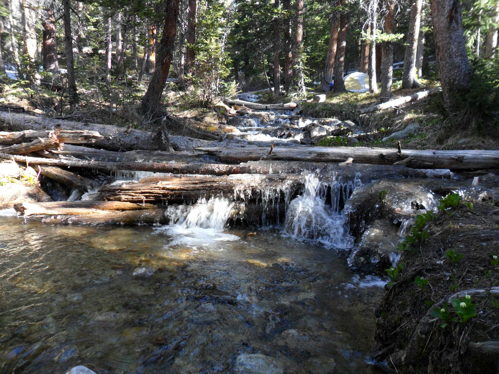
The only real creek crossing on the last stretch.
Four-star lodging at 10,500'.
!!!
A peak down toward the Arkansas River Valley.
By now, I was absolutely exhausted. The last half-mile and the lack of +/- was much appreciated - each of the previous two miles coming off the low point of Yale's ridge had dropped over 1,000'. Real quad-busters.
To the ultra-crowd: highly recommended run. If you're not looking to get in quite as much scrambling and rock-hopping, you could do this loop with Browns Pass instead of Yale's summit. That would likely put it at more like 21 miles and 5,500' climbing. I would recommend doing it either way if you're not planning on hitting Yale's summit. However, descending via Denny Creek allows you to maximize your running mileage. Done in the other direction, you would have to be much more careful with your footing on the descent.
To hikers: after getting a chance to soak in Yale from all directions, I would recommend this: do something other than the standard route! The northwest ridge from the North Cottonwood TH is doable as a day-trip and fairly straightforward. The trail to Kroenke Lake is beautiful and in good shape. The ridge itself doesn't have a trail, but it is scree-free. If you choose to do the east ridge, I would recommend coming from Avalanche Gulch and not Silver Creek. Silver Creek has a couple of rather unpleasant miles of trail - exposed to sun, kind of steep, just a trail on the side of a hill. Avalanche Gulch's approach is much more scenic.