Showing posts with label fourteeners. Show all posts

Sunday, May 1, 2011

Crestone Peak - a near-epic

Crestone Peak (14,294') attempt from South Colony Rd. (9,467)
18.4 miles, 7,700', 17h1min RT
Climbers:  Sean, Terry, Abe

People throw the noun 'epic' around too freely, so I'll resist the urge to do so.  Nonetheless, any seventeen-hour day, even if it goes according to plan, has to be viewed as more than simply a walk in the park.  This was such a trip.

4/30/2011 - Crestone Peak (14,294')
from South Colony Rd. (9,467')
18.4 miles, 7,700', 17h1min RT


Cale's mom flew in to the Springs to spend some time with him this weekend, so I found myself with a rare school-year weekend free.  Sure, I've got a little fun run coming up next weekend, but the need for some spring mountain fun trumped discretion.  Trouble wasn't too far away, as a climbing buddy of mine, Terry, was looking for partners on a spring ascent of Crestone Peak via the snowed-in "red gulley."  Besides a winter mountaineering class I took earlier in the month, I hadn't spent any time in the mountains since October!  I'd been up "the Peak" via the red gulley twice already, but that didn't deter me from contacting Terry to tell him I was in.  I had my reasons.
  1. This was a rare chance to visit the Crestones in full-on spring conditions.  
  2. Ascending a mountain with crampons and an axe is a totally different experience than scrambling up solid rock.  
  3. It's hard to find partners for the more challenging peaks in snow.
  4. It would be a great way to get some serious aerobic work at altitude without incurring the higher impact and recovery cost caused by running.
Knowing that the snow would keep us a long way from the standard trailhead, we knew we were in for a long day.  I didn't realize JUST how long at the time, though.  This being understood, I agreed to meet Terry at the park n ride near his place in the Springs at 0100.  I managed about an hour of shut-eye beforehand and sneaked in a few more minutes on the drive down.  Not a big deal; I'm used to not sleeping well the night before big events, whether due to inability to sleep or early alarms.


There is much confusion when people speak of the "South Colony" trailhead.  Let me try to clarify using distances.
  • 0.0 miles (8,800') - the lower trailhead.  This is located at the very foothills of the Sangres in the Wet Mountain valley, before trees even begin to appear.
  • 1.2 miles (9,467') - where we were able to drive before snow cover made the road impassible.
  • 2.7 miles (9,950') - the NEW upper trailhead.  As of August 2009, this is the furthest point that vehicles are permitted to drive.  There is a parking lot, gate, and register here.
  • 5.5 miles (11,040') - the OLD upper trailhead.  The road between the new and old upper trailheads has now been closed for over a year and a half.  It used to be a very rough road, impassible for all but the heartiest 4WD vehicles.  
In other words, we had to tack on an extra 3.0 miles RT due to the snow.  It doesn't sound like a big deal, but those extra miles at the end of the day are possibly the longest one can ever experience.  Good ultra training, I suppose.

Terry had been in contact with two other guys, Abe and Charlie.  (a bunch of other people wanted to join the trip, but none had avi gear, so Terry rightly turned 'em away)  We met them at the "trailhead" at 0400, exchanged introductions, and were on our way up by 0430.

The approach to any mountain always contains much exuberance and banter, and yesterday was no exception.  Terry, like myself, had been up the Peak twice already.  Neither Abe nor Charlie had been in this neck of the woods before, and we kept hyping up the famous view just around the corner.  With heavy day-packs and snowshoes, our first few miles clicked by a half-hour at a time.  Quite the difference from the early eight minute miles of a long run.  From early on, Charlie wasn't feeling it, and he turned around within the first hour.  It's always a tough decision to call it a day, but I commend him for not putting the party in jeopardy later on.  The three of us continued on and reached a point just before the old upper trailhead at 0700.

It's still winter up there!

Another change that the Forest Service has made in the basin is that they have officially added a "shortcut" trail.  In the past, the standard approach to Humboldt and Crestones followed an old jeep road as it contoured underneath Broken Hand Peak.  As you can see on the map (in blue), it's not a straight shot  As far as I know, a social trail had existed that bypassed this inefficiency(red).  Only recently, though, has it been given signage.

Broken Hand Pass is the low
point between Broken Hand
Peak(L) and Crestone Needle(R)
Our first challenge of the day now awaited:  Broken Hand Pass.  The red gulley route from South Colony is somewhat unique in that it requires not just one climb.  We therefore had more than one aspect to consider.  While the red gulley is south-facing, the snow-filled side of Broken Hand Pass has a NE aspect and therefore vastly different snow.  We found it to be solid, dry, slabby and light through the top two to three inches, and sugary and dry underneath.  We saw no evidence of slides in the area.  Terry and I decided that although not pleasant to wade through, it was safe enough to give it a go.  The summer route up Broken Hand Pass ascends as soon as you hit Lower South Colony Lake.  Before even making it to the pass, it gains nearly half the elevation to the pass.  Instead of dealing with a mixed traverse, we simply crossed along the frozen lakeshore and went straight up.

Lower South Colony Lake is
down there...somewhere!
This was far and away the most discouraging part of the trip.  We postholed the majority of the way up, a couple of times as much as hip-deep.  We didn't top out on the 12,900' pass until 10:30 - we were already six hours into our day.  Demoralizing!  If conditions in the red gulley weren't significantly better, we agreed we'd be turning around.  The view from atop the pass, as usual, was stunning.  It was neat to witness Abe's reaction as he experienced it for the first time.  I believe this was my seventh time atop Broken Hand, but because of the labor involved in getting there, this surely was the most satisfying trip.

View of Crestolita (I think) from atop Broken Hand Pass.

We barreled down the other side of Broken Hand Pass, relieved to be done with that mess and excited to get a glimpse of our real objective.  Going was still not quick, though.  We got to Cottonwood Lake, exchanged crampons for snowshoes, skirted the lake, and enjoyed our whitewashed surroundings as we made our way to the base of the red gulley.  In the Cottonwood drainage, it actually felt hot for the first time all day!


Cottonwood Lake
Lots of snow.
The red gulley snakes up the center of this picture.
The summit is just to the left.
The gulley isn't so red this time of year.
A closer look at the gulley.
We entered from the right on the
snow band just below center.
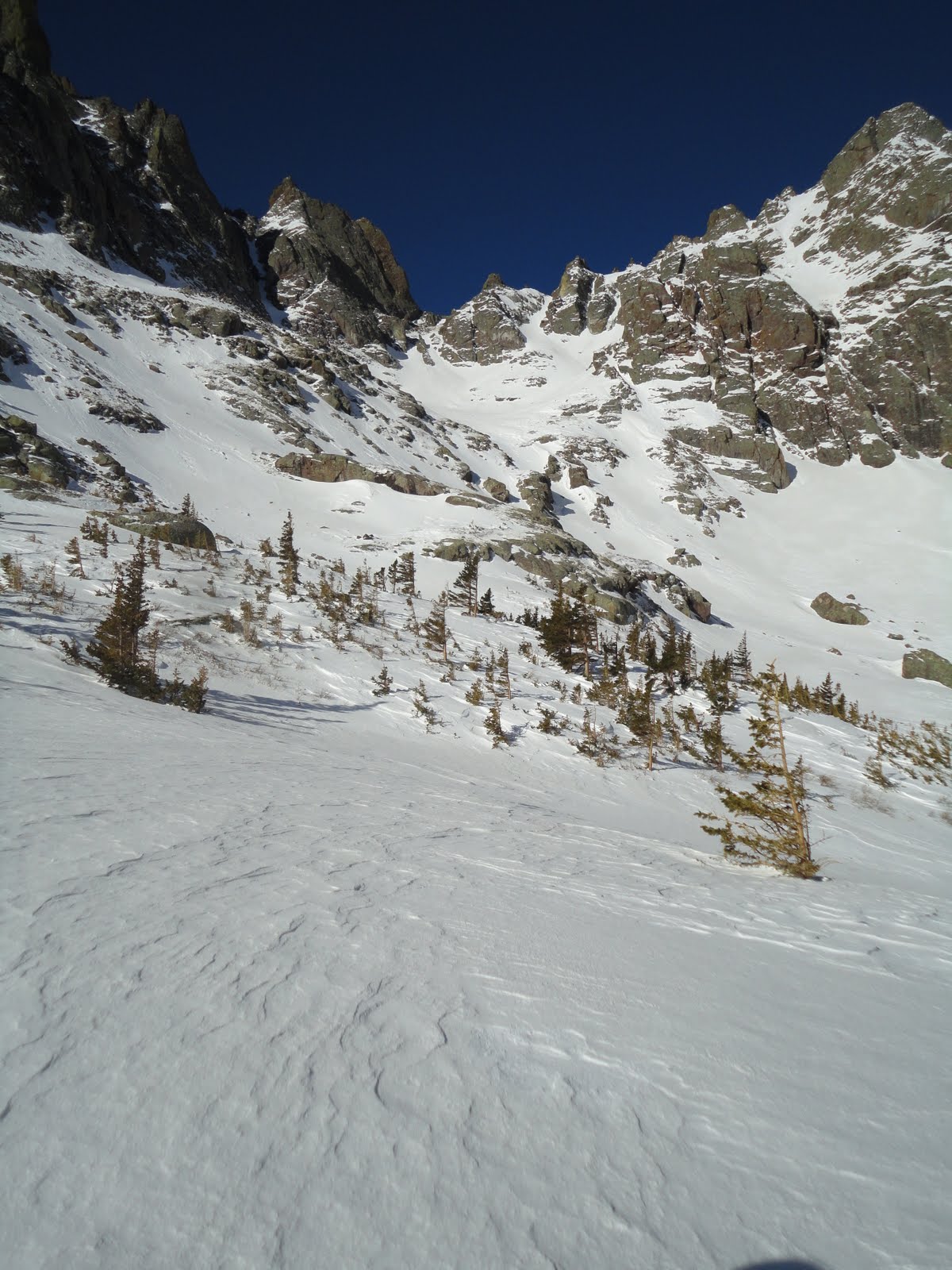
Sure enough, we found the gulley's snow to be much more compacted and firm - it was a go!  The events of the ascent were scant.  One rock band early on provided a chance to get sporty and use points in a mixed setting for about 20'.  Otherwise, we just kept going up, up, up.  My emotions were mixed - I love scrambling up the Crestone's conglamorate, and the red gulley provides that aplenty in the summer, but the remoteness and ruggedness one is surrounded by when ascending a couloir in the spring may be better.  It just doesn't feel like the same place.

Crestone Needle, as viewed from the red gulley.

Going up!

The southern Sangres.
The Sierra Blanca massif can be seen in the background.

Abe and Pico Asilado

Almost there

 Finally, we hit the 14,200' top of the gulley.  All that remained was a short scamper over fun rock...or so I was hoping.  The recent storms had deposited enough new snow on the south-facing slabs that no simple route was evident.  Furthermore, the traverse over to the ridge was corniced over with stuff that looked (and felt) like it might go any minute.  Ten and a half hours and many miles in, we decided to call it a day.

Terry topping out on the gulley.
hero shot
Knowing that it's already 3PM and you still have many, many hours of climbing and hiking left can be a real buzzkill.  I had been preparing myself to deal with this reality the whole way up, so when we had to downclimb the gulley, I was ready.  The initial few hundred feet were difficult and we had to face in, but as we descended, the snow softened just enough to begin plunging down.

For anyone who has done this route from South Colony in the summer, you know how miserable the re-ascent of Broken Hand Pass can be.  While the snow cover on this side was scant, we still needed snow shoes to avoid knee-high postholing.  I don't think one non-explicative was muttered the entire way back up, as all three of us were in our own little private hells.  Even the stopping to switch out footwear became arduous.  (In total, I think we switched either into or out of snowshoes or crampons a total of seven times)  The descent into South Colony wasn't much better than the initial climb, and the thought of knowing we still had hours of trudging ahead overshadowed the beauty of the closing light on the high peaks surrounding us.

Getting ready to return down Broken Hand Pass.

We finally made it back to the cars at 9:30PM.  It had been by far the longest day of my life - surpassing my old longest day by a good four hours.  While I wasn't too beat up physically, I felt like a walking zombie from lack of sleep.  The three of us struggled to enjoy our post-climb Old Chub's.  Terry and I said goodbye to Abe and began the drive back to Colorado Springs.  I maybe said two words to Terry the entire drive home as I kept nodding off.  I don't know how he stayed awake.  For all I know, he didn't.  I was too tired to tell.

Saying good bye to the Crestones.

This doesn't qualify as an epic, as we didn't call SAR, get off-route, or do anything entirely sketchy.  However, just the time spent on our feet was staggering.  Top ultra runners can complete 100 miles in seventeen hours.  The cutoff for Ironman finishers is seventeen hours!  While we didn't do a 100-miler or an Ironman, though, we did feel like we accomplished something.  A great journey in bluebird spring conditions to a beautiful part of the state - can't ask for much more than that.

Saturday, April 16, 2011

F***

Cancer.  a malignant tumor of potentially unlimited growth that expands locally by invasion and systemically by metastasis.

Or just a scary-ass word that invokes the words, "Oh, fuck" from even the most pious monk.

Talked to my mom on Monday and found out that each of my parents found out this past week that they both have cancer.  Prostate is my dad's flavor, while my mom has the pleasure of breast cancer.

That's the bad news.

Good news, which has been trickling in throughout the week, suggests that neither of them are about to drop dead or have to undergo nasty, years-long battles with this enigmatic cellular deviant.  Doc told my pops that he'll likely die WITH prostate cancer, but not OF prostate cancer.  Mom has to undergo a mastectomy, but it looks like she gets to avoid the twin horrors of radiation and chemo.  She'd been good about getting annual checkups.  Here's to early detection!


When the headhamster starts spinning, I think adventure.  Newest idea - I'm not sure how well it will fit into my training, but I'd love to run the four pass loop this summer.  Looks more and more like I need to spend a good week up around Aspen...I hafta find a passable route between Snowmass and Capitol as well.

As I've frequently alluded to in the past, I run as much to process the crap that life throws my way as I do to keep from getting fat, feed my ego, and get rid of excess energy.  So it's always a bit strange to sit here and write down how far or fast I went on any particular day, as if the numbers define that event or something.  Nonetheless. 

20 flat miles in the dark this AM.  10 out easy (8:15's) on the Santa Fe, and 10 back averaging 6:30's.  I was curious to see what was under the hood after 18, so I brought home the last trail mile in 5:40.  Iced and stretched afterward.  In no point of my training has a twenty ever felt so inconsequential - I felt I could have easily tacked on a ton more, and would have done so if daddy obligations didn't begin around sunrise.


The Santa Fe is a mixed bag.  I love being able to translate mile splits into fitness and such, but I'm sick of the same damn thing every day.  Today's run only included 600ish feet of elevation gain.  I can find that in 2 miles outside the front door of my school.  Speaking of which, Cheyenne Mtn is a week away, and it's not exactly flat.  This week has seen me return to near-normal mileage (53 miles after 6 days) and intensity.  The only thing left to add back in to my full regimen is hill work.

And maybe this week can bring a little less news.


Wednesday, March 9, 2011

Lindsey

Hill repeats up the face of the South Suburban Reservoir.  Reminded me of track practice back in high school - short, intense, made me wanna puke.  I kinda liked the feeling.

14,042' Mt. Lindsey - Sangre de Cristo range
Talked to my old HS coach this morning.  Colorado Trip 2011 is a go - this will be the sixth year in a row that kids from Wayzata have come out for some good ol' altitude and camping.  I think I'll take them up Lindsey, which is a class 2+.  It's not like JT is coming, so I think they'll be fine.  I've taken them up La Plata, Humboldt, Pikes, Uncompahgre, and Massive in the past.

To tell you the truth, I just wish Saturday would hurry up and get here.  I'm kind of itching to get this marathon out of the way so I can focus on Collegiate Peaks.  A lot of the same characters will be at both races.

Old-school punk on order tonight.  Just for you, macho.